Survey Details
This details module displays information about building and archaeological surveys. Surveys provide information to SHPO reviewers and researchers about cultural resources throughout New York State. These are divided into three types:
- Building Surveys: Inventories of built resources, including buildings, structures, objects, above-ground sites, and historic districts. These typically include photographs and descriptions of each resource, as well as a contextual history of the survey area. Building surveys are available to all users of CRIS.
- Archaeological Surveys: Investigations of archaeological sites or areas that are potentially archaeologically sensitive. These are often conducted as part of a consultation project.
Note: Archaeological surveys are available only to CRIS users with archaeological data access privileges. To apply for archaeological permissions, please complete the PDF application form and email the form with supporting documentation (if applicable) to CRISHelp@parks.ny.gov with the subject “Archaeology Permission Request.”
You will need to log into CRIS with an NY.gov ID account at least once before SHPO can enable archaeological permissions for your user profile.
- Trekker Surveys: Building surveys that are collected using the CRIS Trekker suite of applications.
You can open the details module for a survey in the following ways. For archaeological surveys, you must have archaeological permissions.
- Search for the survey and click the View button for the survey in the Results tab.
- Click the survey polygon in the map interface, and then click the View button in the callout balloon.
- Go to the Surveys tab in a USN or project record and click the View button for the survey.
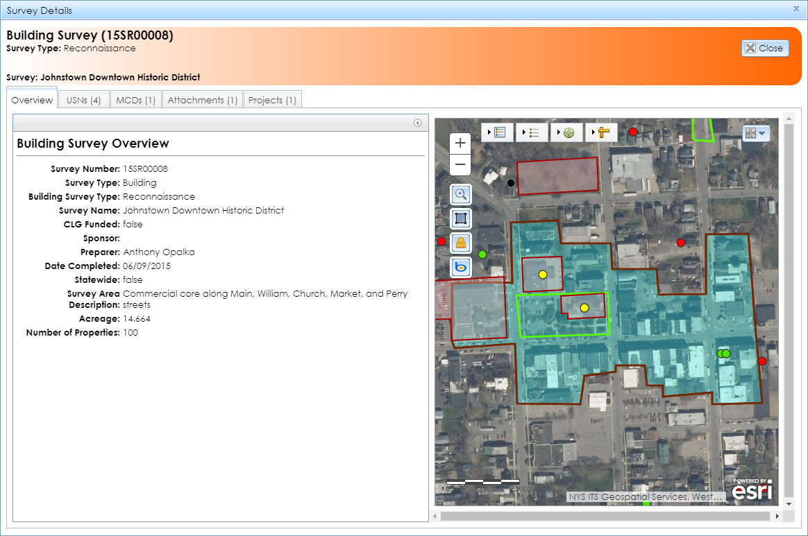
When you open the module, it will display with the Overview tab open by default, as shown below.
- Header: The primary information about the survey will display at the top of the module. This includes the survey’s number, type, and name.
- Overview: Detailed information about the survey.
- USNs: Any USNs that are linked to the survey, as well as submitted resources that were included in the survey submission. Click the View (magnifying glass) button to open a USN or submitted resource.
- MCDs: One or more counties and minor civil divisions (MCDs) in which the survey is located. MCDs include cities, towns, villages, reservations, and boroughs.
- Attachments: One or more attachments that make up the survey report, as well as any supplemental materials. Click the download (green arrow) button to open or download each attachment.
- Projects: Projects that are linked to the survey. These are hidden from external users.
