|
The Proposed District form within Survey123 has several sections to be completed (District Boundary, Streetscapes, Basic Property Data and Intensive Property Data). Required fields are marked with a red asterisk.
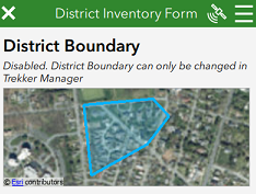
District Boundary
This section provides a map display that shows the boundary of the proposed district (created in Manager). It should be noted that the map is disabled and does not allow the user to adjust the polygon in Survey123. However, similar to the Building Inventory form, the map can be clicked to display a larger, interactive map to view the area. To close the interactive map, click the < button in the upper left corner.
Streetscapes Guidance
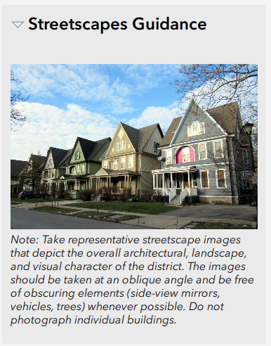
Immediately above the Streetscapes photo section is a collapsed section named “Streetscapes Guidance”. There is no data to be collected in this section. It is simply a “help” section which can be expanded to illustrate the types of streetscape photos requested by SHPO as shown in the image below.
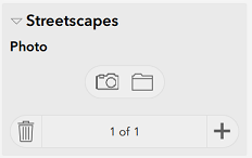
Streetscapes
This section allows the user to capture one or more streetscape photos of the district
Adding Streetscape Photographs
Click the Camera icon to take a photo, or click the Folder icon to upload an existing photo that is already stored on the device (perhaps the photo was taken earlier outside of Survey123).The photo will display within an expanded interface with extra controls as shown in the image below.
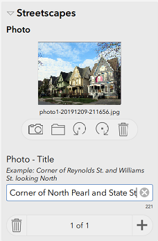
Next, enter a title for the photo in the text box (e.g, "Corner of North Pearl and State St looking South")
Rotating the Photo
The photo can be rotated by clicking the rotate left or rotate right buttons under the photo
Removing the Photo
The photo can be removed from the inventory form by clicking the Trash can button under the photo
Capturing Additional Photos
To capture additional photos, click the PLUS button in lower right corner of section and repeat above steps
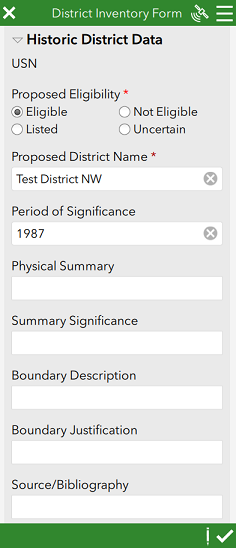
Historic District Data
This section has several required fields and allows the user to capture the basic data associated with the proposed district.
|