
If you are an authenticated user, you can select certain map layers that will display by default in all map interfaces. For example, you may wish to display only archaeological features, or to hide consultation project areas.
To set the default map layers, click the My Profile link in the upper right corner of the CRIS web page, then click the Manage Map Layers button. A separate module window will open, as shown below.
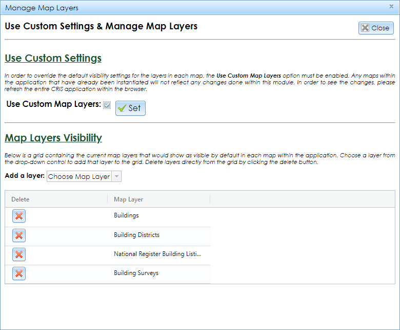
Under the Map Layers Visibility heading, select each layer that you want to display by default. These will be added to the grid. If you want to remove any layers from the grid, click the red X button.
To enable your selected default layers, check the box to the right of Use Custom Map Layers and click the Set button. To reset the maps to their default layers, uncheck the box and click Set.
Click the Close button to exit the module. Reload the CRIS web page to make your changes take effect.