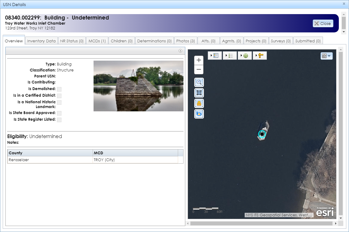
The Overview tab in the USN Details module contains the map interface on the right, with the USN’s point or polygon highlighted in light blue, as shown below. If the USN is not yet mapped, the map will zoom out to New York State and the message The USN location does not exist in the GIS
will display above the USN information.

On the left is a list of fields that provide basic information about the USN, as well as a primary photograph if one is present. If the USN does not have any photographs in the Overview or Photos tabs, the scanned inventory form may still have photographs. If the USN has an inventory form attachment, you can open it by going to the Attachments (Atts.) tab and clicking the download (green arrow) button for the form, or by clicking the Inventory Form button in the header of the details module.
Note: This field may not reflect the USN’s current contributing status. To confirm a USN’s contributing status, SHPO recommends that you check additional documentation.
If the district is listed on the State and/or National Register, check the National Register nomination form for the district by opening the National Register project from the map interface. The nomination form will be under the Attachments (Atts.) tab in the National Register project.
If the district is not listed, check the inventory form for the USN or its district under the Attachments (Atts.) tab in the USN Details module, or check the building survey for the district under the Surveys tab in the USN Details module.
You may also contact the appropriate reviewer from the Survey and National Register Unit, as listed on SHPO’s Contact page.
This eligibility may warrant re-evaluation based on new informationwill display. This means that SHPO may replace the most recent determination with a different one if new information justifies the change.